Wednesday, January 25, 2006

fake meat

I don't know why, but New Zealand loves really bad junk food in
meat-like flavors.
One of the first days after I arrived in this country, I just had to
try a product on the convenience store shelves, next to the potato
chips and Cheeto-like products. In one of the many mass-produced
bags, as advertised in giant orange letters, were "Burger Rings."
The product is vile. Think cheetos shaped like a circle, with a bit
of beef extract caked on.
But it's nothing compared to my next foray into the meat-flavored
snack genre. After trying to eat some chicken flavored chips, I
turned the bag over to read the ingredients.
The relevant entries: Artificial flavors (622, 624, 626) and Chicken Fat.
At least it's not all artificial.

Thursday, January 19, 2006

Not quite home again

This isn't quite where I grew up. In fact, it's on the other side of the world from where I grew up. It does, however, have the same name.
If you are one of the billions of people who are not from Geraldine, Montana, or Geraldine, New Zealand, you may not be interested. Even if you are, you may not be interested. Either way, I feel the need to post this picture.
(For those trying to follow along: I grew up in Geraldine, Montana, population a little less than 300. I drove through Geraldine, New Zealand, population about 2,500, and took a picture).

Wednesday, January 18, 2006

a new creation myth

The Maori have a myth about the creation of New Zealand that involves
an ancestor catching a giant fish, which then turns into the North
Island (to paraphrase the whole thing and butcher their cultural heritage).
On Sunday, four of us took a trip a few hours east of Wellington,
along the North Island's southern coast. The drive took us from
Wellington, across a heavily-ferned mountain pass, through green
sheep farming country. Nearer the coast, the landscape turned brown
and dry, with long grasses. As we drove along the coast, at times the
road was boardered by white cliffs. Other times, by black rocks
poking through the ocean. And these are just a few of the different scenes you can find in this
country.
My roommate Steph said she had a theory about the landscape changes:
She said when God was creating the world, as he sculpted the land of
each country, there was a small bit left over. When he finished with
all the world's regions - desert, mountains, rainforest, grasslands,
beaches, the whole bit - he took all those small leftover parts,
wadded them together, and threw them away. The clump of extra parts
landed in the ocean and broke into two pieces - New Zealand.
As we drive around this country, it's easy to believe this is the case.

(NOTE: the first paragraph has been reworded so I am no longer implying that the fish butchered the Maori's cultural heritage)

Sunday, January 15, 2006

Dec. 27

Surat Bay to Invercargill

More stops at the end of graveled roads. We walked across sheep pastures situated right off a beach, ending up at a hole in the earth with sea water crashing below. We walked on a boardwalk into marshland, and estuary deserted except for one shorebird picking his way along the mud.

We finally arrive in Invercargill, the southern-most city in New Zealand (with a population of about 50,000; city being a relative term).
Invercargill is the least-attractive city I've seen in New Zealand, and if it wasn't for the proximity to the Catlins and the further south Stewart Island, I'd advise avoiding it at all costs.
It reminds me more of the American midwest than anywhere else in NZ, an industrial town on a flat plain. Wide, empty streets lined with businesses that long ago lost any veneer of newness. Lonely litter blowing in the wind. It could just as easily been in central Kansas or Nebraska as in New Zealand.
We met a pair of college-age locals, back in town on holiday break. We talked about the state of their town, and one of them offered, "It used to be worse."
I decided that should be up on billboards as people drive into town.
Invercargill. It used to be worse.

Dec. 28-30

Invercargill to Stewart Island, and back

Invercargill did have two things going for it. One, the hostel was quite nice - a refurbished house, complete with two things I've rarely, if ever, seen anywhere else: free internet and a dishwasher.
Two, it was large enough to let us take the car in for a check while we prepared to head south to Stewart Island.

Stewart Island is the "third island" of New Zealand, but on the map is just a small chunk of land hanging just below the South Island.
The human population of the island is even smaller. There is one town, Oban, of about 300 people. There are no roads outside of the small town, and most of the island is a National Park.
What Stewart Island does have is a ton of birds and plants rarely found anywhere else. Although there are some introduced predators on Stewart Island, tiny islands just off shore have been cleared of the non-native mammals and are now bird sanctuaries.
We arrived late Wednesday after the one-hour ferry ride from Bluff (there is no regular car ferry, so I never learned exactly how the streets of Oban came to be full of parked cars). A few short walks on the outskirts of town and a stop at the town pub filled the rest of the evening.

Thursday brought a water taxi ride and walk around Ulva Island, one of the main bird sanctuaries. The birds here were not shy, especially the flightless Weka, which gave the impression of small, brown and streamlined chickens. There were sightings of parrots, parakeets, and a multitude of songbirds in the five hours or so we walked about.

We had to wake early on Friday in order to get back to Invercargill in time to pick up our car, now with new front brake rotors and pads. Then came a long and nearly fruitless (but very necessary) search for a laundromat.

Dec. 31, 2005 - Jan. 1, 2006

Invercargill to Queenstown to Te Anau

My first thoughts of the New Year were: 2006's weather is crap.

One day, 2005 is ending in beautiful fashion. The weather was outstanding as we made our way north and into the mountains to Queenstown, the tourist capital of New Zealand.
The townhugs the shores of Lake Wakatipu underneath the vertical rock walls of the Remarkables mountain chain. Like mountain resort towns everywhere, Queenstown is not a place for people to live. It is a place for people to spend money. The outer-most areas of town consist of ostentatious homes or huge-windowed condos. Slightly closer to the center are luxury hotels, which give way to trendy shops, restaurants, bars and clubs. In the midst of it all are advertisements and booking desks for just about any adventure activity you'd care to spend money on - skydiving, jet-boating, parasailing, bungy jumping, bungy jumping from much higher up, fly-by-wire, luging, plane tours, plane flying, whatever.
On New Year's Eve, also in the midst of it all were about 10,000 tourists booking out almost all the accommodation. However, the town or the local rugby club or someone graciously allows people to set up a tent on the local rugby field for a price. We had a tent, we had a place to stay. We walked around in brilliant sunshine, took a gondola to an peak above town, watched some cricket, and then settled in for midnight fireworks.

Waking up on New Year's Day, the sunshine was gone, replaced by grey clouds and drizzling rain. We packed up and headed west, bound for Fiordland.

Jan. 2

Te Anau to Milford Sound, and back

More rain, but it's hard to complain - parts of the area average more than an inch of rain a day.
The 75-mile drive to Milford Sound is billed as one of the most scenic in the world, and it certainly has a lot to look out - following a mountain valley up until finally reaching the head of the valley, then driving through about a mile-long tunnel to get to the other side and a swift drop down to Milford Sound, one of several glacier-carved sea inlets, lined on all sides with sheer vertical natural walls.
The end of the road, Milford Sound's visitor centre, is one of the major tourist destinations of New Zealand, but it's somewhat of a letdown. Unless you're planning on taking one of the many cruises through the sound, it's the drive and the many walks along the way that make the journey memorable.
Everywhere you look in Fiordland there's a waterfall, especially if you're there when it's raining, as we are. We walked to several waterfalls, and lakes, and other points of interest - it took us nearly six hours to go from Te Anau to Milford Sound, and an hour and a half to get back.

Jan. 3

Kayaking Doubtful Sound, then Te Anau to Queenstown

This is the real reason we're here - a chance to kayak the fiords.
The day starts early - 7:30 a.m. check in. We take a short van ride from the office to a lake, then a 45-minute boat ride to the end of the lake, where a bus waits. There's a gravel track across the mountain pass dividing lake and sound, put in to service a hydroelectric plant.
After the bus winds its way down to the Sound, we transfer to another boat. A short ride out, and we drop kayaks into the water and get out.
Again, the day is wet and cold and wet. The rain goes from light to heavy to light again, but it's always raining. We are provided with wet suits and three layers of rain gear for our exposed torsos, so the rain is easy enough to contend with once we are on the water.
Again, there are waterfalls everywhere you look. This water doesn't have a chance to wander to a stream bed to join with water from other areas. The water simply streams down off the cliffs, trying to get from summit to sea level as quickly as possible by falling down sheer rock.
The mountains get so much rain, trees grow on the bare rock, rooted in the thick carpet of ferns. As the trees grow, eventually they reach a weight which cannot be supported by the mat of vegetation, and they fall. Often, the fall creates an instability in the underlying mat which leads to surrounding trees losing their anchoring as well. An avalanche of vegetation results, creating bare paths along the green mountain side. Eventually, a few ferns attach themselves to the bare rock, and everything starts again.

More kayaking, then back on the boat, back on the bus, back to the lake and the next boat, back to the shuttle, back to the car. Wet day, but good day. Best scenery of a scenery-packed trip.

Jan. 4

Queenstown to Franz Josef Glacier village

A driving day. The route winds through mountain country before crossing the Southern Alps and suddenly finding the coast. Again, it's spectacular, but at this point we're a little bit desensitized to rock soaring upward. It is an amazing country, however, where you can be winding your way up along a mountain road, seeing nothing but up on one side and nothing but ocean on the other.

Jan. 5

Franz Josef Glacier to Greymouth, via Fox Glacier

On the other side of Mt. Cook and its posse of nearby peaks, snow piles and compresses into ice, which snakes down mountain valleys. Two of the glaciers, Franz Josef and Fox, are in valleys narrow enough the ice makes its way down to the flat land at the base of the mountains.
We don't spend the money to walk on the glacier or in the ice caves, or to fly over the ice and the Alps. We do take the walks to the ice face of both.
It is odd to think of a giant block of ice as a moving stream, and they say these glaciers are advancing at the rate of about a meter a week, and can move as fast as a meter a day.
It's also odd to see the ice face - the glaciers don't gradually give way to rock, they suddenly stop. Walking up to them, you follow a wide, rocky valley floor interrupted by streams of water. Suddenly, the rock gives way to an ice wall 20 or 30 feet high.
Both are impressive, but on this day Fox Glacier is the more interesting of the two. The approach to Fox is in a narrow valley, with ice-scraped rock walls on both sides, from the centuries before when the ice made a strong advance.
Then, there is an hour-long walk along the side of the valley to the ice. A rope is up about 100 feet from the ice, warning people of falling ice, but most visitors ignore the warnings and the rope and walk up to where a strong flow of water comes out from below the ice, carrying away blocks of ice and the water that has finally regained its liquid form.

We head north, and decide to stop in Greymouth. Another nondescript town, it is the second town on our trip for which a slogan immediately springs to mind.
"Greymouth. Better than Invercargill."

Jan. 6

Greymouth to Nelson, via Punakaiki

Pancake RocksContinuing our rapid movement up the west coast, we (again) spent most of the day in the car, with a long stop at Punakaiki, home of the pancake rocks.
The rocks have, as the name implies, thin layers which look like they are stacked on top of each other. They have also been well-worn by the sea. In places, waves have carved out caverns at the bottom of the rocks, and eventually worn through the ceiling of the cavern as well, creating a spray up through the rock during high tide.

We drove further along the coast, stopping to see a seal colony, before heading back inland to get to Nelson. There we were meeting our former German roommates, who had just left Wellington (and our apartment) to start their own South Island trip.

Jan. 7-8

Nelson to Golden Bay to Nelson, then to Wellington

The four of us (Kirsten, me and the Germans) drove Northwest, toward Golden Bay. Most of the day was spent driving along another winding road over a mountain pass, along with a side trip down a long rough gravel road for a walk to the largest holes - dropping into a cave system - in New Zealand.
We couldn't actually get close enough to see much of the hole, but we could tell it was there.
Golden Bay we could see, and it was Golden - we picked up a pizza to eat on the beach at sunset. Essentially it was the end of the trip, and a good one.
However, Kirsten and I had to drive the two hours back to Nelson. On Sunday we woke up and drove another couple of hours to Picton, and rode back on the ferry.

We're back in Wellington for a few more months, although we're trying to squeeze in more long weekend trips. We're also trying to figure out our plan for the rest of our time here and possibly more global travel before returning to the States and trying to resurrect our careers.
I'll keep you posted.

Wednesday, January 11, 2006

December 21

Wellington to Picton

Riding the ferry is less like traveling on an airplane than traveling in a moving airport.
The Interislander ferries, the boats of the largest company transporting people and their cars between New Zealand's North and South Island, offer a number of in-route entertainment. There's a bar, a restaurant, food court, kids' play area, cinema (although our boat, being new, did not yet have an operable cinema) and several different seating areas, with or without TVs or a view. Also an outside walkway on the boats' seventh story, to experience the weather, see the water, see the land slide by as the boat navigates the channel near Wellington or Picton.
The sun set as we pulled out of Wellington, so there wasn't much of a view for most of the trip. Also not much to do, once you've walked around the various compartments on the boat. So, like an airport, settle in with the newspaper and any other reading material you've remembered to bring.
The boat wasn't particularly full, not like it would be on our return trip, but the beginning of the holiday crush did lead to delays. Our departure was slightly late, but on arrival we were put in the marine equivalent of a holding pattern, waiting for the even later night boat going South to North to depart the berth our South-bound boat needed. An hour later, well after midnight, we set foot (actually, rubber - we were in a borrowed car for the trip) on the South Island for the first time.

Dec. 22

Picton to Christchurch, via Kaikoura

I'm so far from home I may as well be back again.
The landscape here is different from the nearly uniformly lush, green, rolling hills of the North Island.
Here shades of browns and yellows cling to the hills, dry grasses actually showing patches of dirt. Trees are few, and the air has a smell I remember from summers growing up in Montana - the smell of heat, carrying dust and the essence of dried plants.
Unlike home, the hills lead to the bright-blue ocean and long, sweeping beaches. In Kaikoura, famous for whale-watching, we don't see whales. I do, however, eat a whale-sized portion of seafood - what the Kiwis call crayfish (rock lobster), mussels, chowder. This is one of the beauties of living on an island.

Little time is actually spent in Christchurch, which has a very European-feeling city center, around the cathedral for which I assume the town is named, but has a very generic, almost American midwest, feel more than a few blocks away from the church: Big-box retail stores lining a multi-lane road.

We stay up too late after meeting and drinking with fellow tourists in a pub. On the road we tend to meet people, usually other travelers, in the bars. In Wellington, which has just as many tourists, we don't. Part of it, of course, is that we have our own companions when out in Wellington. But not always. Perhaps when we're not traveling ourselves, we're blinded to the other tourists. Or something.

Dec. 23

Christchurch to Lake Tekapo, via Geraldine

Another Montana connection - one of the few towns I know of worldwide that share a name with my hometown.
I know of three Geraldines, anywhere - Montana, New Zealand and Alabama. I honestly can't remember if I've ever been to Geraldine, Alabama, but I'm guessing I haven't.
New Zealand's version is the biggest of the three, with its 2,300 people, and probably the nicest-looking, with green park space and flowers growing everywhere. Other than that, there isn't much to say about Geraldine, which I think is a characteristic all three share.

We head inland, toward the mountains. We get our first real view of the Southern Alps from a hill overlooking Lake Tekapo, where one of the universities has set up an observatory, and where we watch the sun set over the mountains. They may not be among the tallest in the world, but New Zealand's mountains can rival just about anybody's for sheer vertical rise out of a flat landscape.

Dec. 24

Lake Tekapo to Dunedin, via Mt. Cook


It's not quite the holiday yet, and I don't quite touch it, but it's very nearly a White Christmas (Eve), or at least as close as you get here.
The day is bright and sunny, the plants brilliant green, a perfect day to be in the mountains. We walk toward New Zealand's tallest peak along an old glacier valley, far below a glacier clinging to the side of a sheer rock face topped with jagged peaks and a large snow shelf, parts of which fall off intermittently throughout the day, sending a low rumble through the valley which would be mistaken for thunder if there were any clouds in the sky.
After the second crossing of a river which provides drainage for the glacier and snow melt off Mt. Cook and it's neighbors, again on a swinging bridge, we turn a corner around another, smaller ridge and look straight up the valley to Mt. Cook. It's an impressive sight, and one of the few times I've seen the top of a mountain in NZ without waiting for it to peek through the clouds first.

Further south, Dunedin (the country's foremost university town) feels a little bit more like Christmas, because it feels considerably colder after the sun goes down. Kirsten and I decide to give in to the holiday, and attend a candlelight carol service in the center of town. Most of the carols are familiar, even if occasionally the tune is not. It's fitting for a summer Christmas - the holiday is familiar, even if the setting is not.

Dec. 25

Dunedin, via the south-bound highway out of Dunedin

The car we've borrowed has been making some non-comforting sounds in occasionally braking situations. Metal-on-metal sounds make people nervous. Everything is closed for Christmas - seriously, it's hard to find a gas station open. We decide to press on South and get things looked in a few days, when things open back up, but we make a poor map-reading decision to take a shortcut and end up trying to climb straight up a hill on a gravel road with what is essentially a Geo Metro. We make the top, just as the radiator decides to show it's displeasure with our navigation by sending it's contents out in a plume of white steam.
After letting things cool off, we decide it might be a decent idea to stay an extra day in Dunedin. Since the weather is generally poor - pissing down rain - it's an easy decision to make. Also a good one - at this point on the road, we could use a day to do nothing. Which is just what we do.
At least until late afternoon, when we head out to see a bird colony on the outskirts of Dunedin. The town claims the only mainland albatross colony in the world, but access to the colony is locked (it's Christmas - everything is closed). We watch a thousand sea gulls fly and roost on and around a rock cliff.
The weather gets poorer - more rain, far more wind, less heat. After taking refuge in the car, we decide to act the idiot tourists and step out again. Apparently, the poorer the weather is, the happier the albatross(es?) are. They need the wind to get airborne, and we watch a few of the birds - they look like sea gulls on steroids, with nearly 10-foot wingspans - glide over the sea before giving up and heading back to the hostel to resume our previous activity of doing nothing. Dunedin looks like a ghost town - we find two deserted Chinese restaurants open.

Dec. 26

Dunedin to Surat Bay

Boxing Day, another paid public holiday here, and the streets couldn't look more different. The sidewalks and shops are packed this morning, as apparently a city full of shoppers popped into existence when the sun came up this morning.
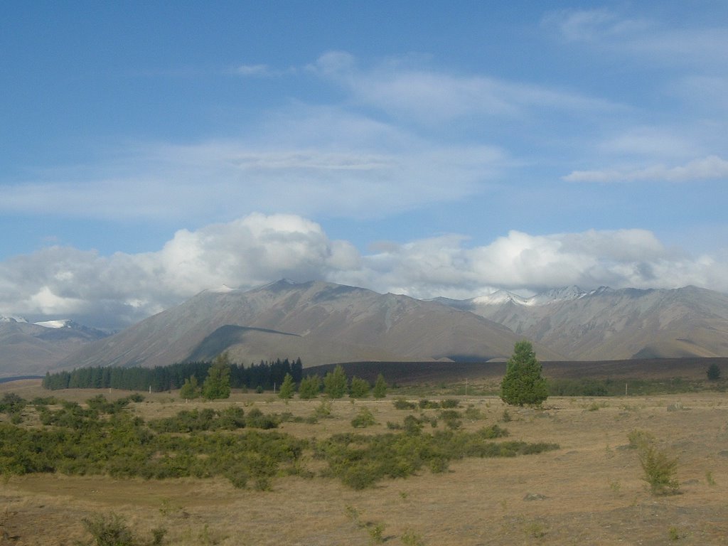
We're getting out of town, though, chancing our car's ability to get us through the southeastern part of NZ, known as the Catlins.
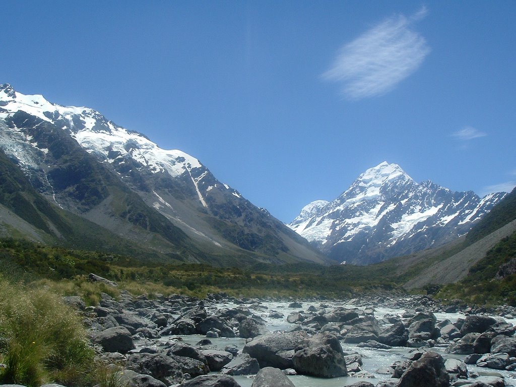
It's an area that's slightly off the main tourist path, but is packed with things to see. Mostly more of the same - beaches, forests, cliffs, waterfalls, birds and sealife - but more of the same in New Zealand is usually pretty good, and there's always endless variations on the theme.
The main difference in the Catlins is that all of the stops seem to be at the end of long gravel roads. This is the peak tourist season, and all of the parking lots are packed. At the more well-known sights, that means there are as many as half-a-dozen cars to contend with.
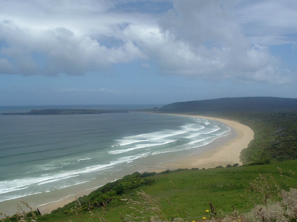
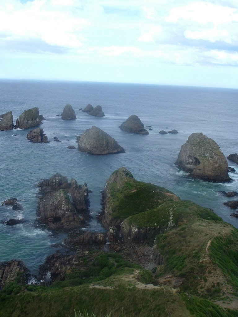
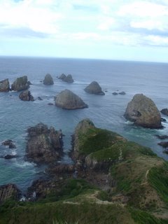
Our main stop is a spot known as Nugget Point, a ridge jutting out into the ocean, topped by a lighthouse. Just past the end of the ridge, where the land drops into the ocean, a series of rocks poke out of the water - the nuggets.
The view is worth it - it's hard to get tired of the abrupt transition from water to land you often get in New Zealand. Even when there is a gentle beach, the hills aren't far behind.
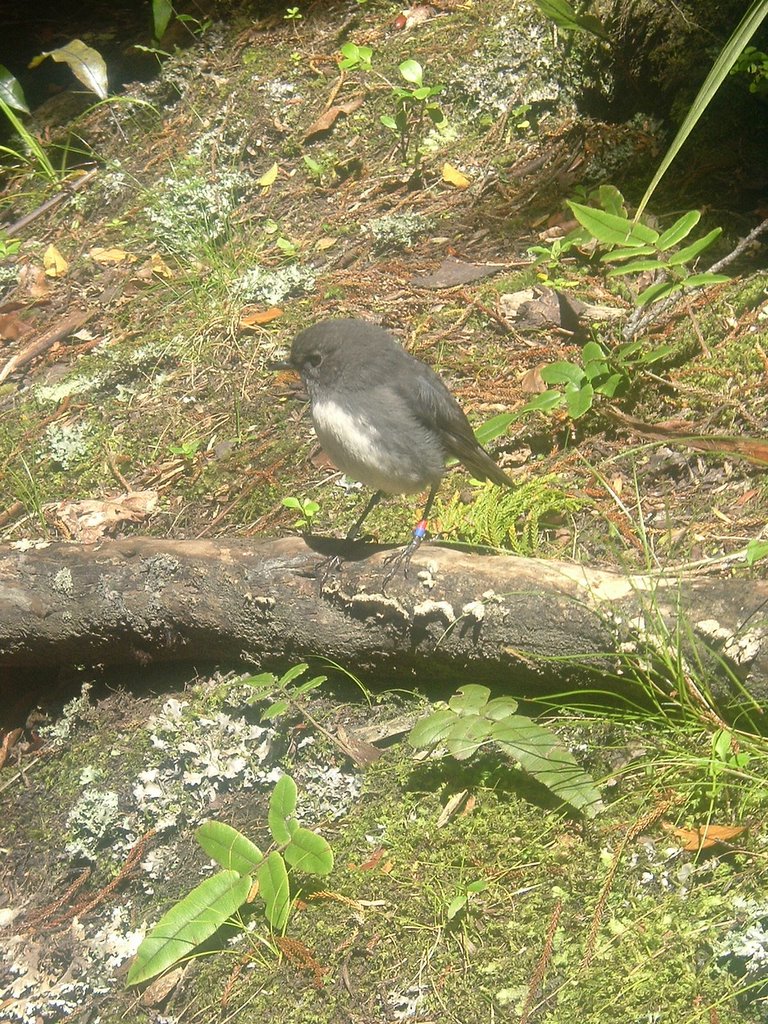
On the other side of the ridge, set back from the lighthouse, there is one of those beaches, tucked under a steep hill, providing just a sliver of transition from land to sea. Here there is a small hut, providing stealth for us and comfort for the penguins who land on the beach and have nests on the hill. Rather shy, the yellow-eyed penguins apparently won't land to feed the chicks if they see much movement on the bank. The hut, however, gives us a vantage point to watch the penguins as they come ashore to feed newly-hatched chicks.
Penguins are a breed I've never seen before outside of a small aquarium enclosure. As always, the birds' odd walk provides humor, especially as they clamber up the hillside. But it is a striking sight to watch the black-and-white birds, looking more animal than bird-like, and to human eyes somehow giving off an air of knowledge, walking out silhouetted again the sand before disappearing into the waves.

Sunday, January 08, 2006

I'm back, sort of

Back from the trip - 3,900 kilometers of South Island action (about 2,400 miles) down the west coast, along the south coast, up the west coast. Lots of mountains, beaches and rain. However, full dispatches from the trip await the return of my laptop and a better internet connection.