falling water
 The archived ramblings of my time as a world traveler up to my current life in Washington, D.C.
I've finally gotten some updates from the road trip up (now that I've
finally re-gained Internet access). The comments are dated from the
days I was on the road, so they start with Nov. 13. I've got about
half the week up now, and more will come in the next day or so.
NOTE (Nov. 27): the week's posts are finished.
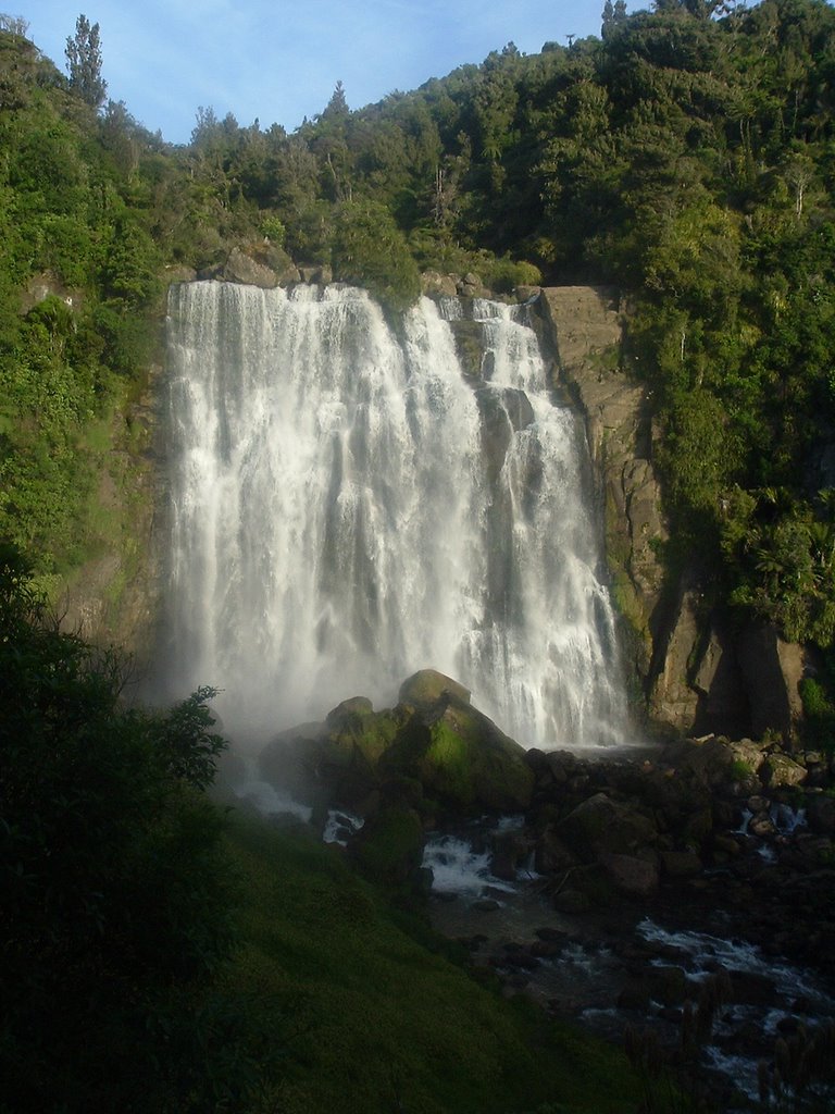
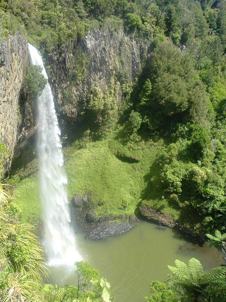
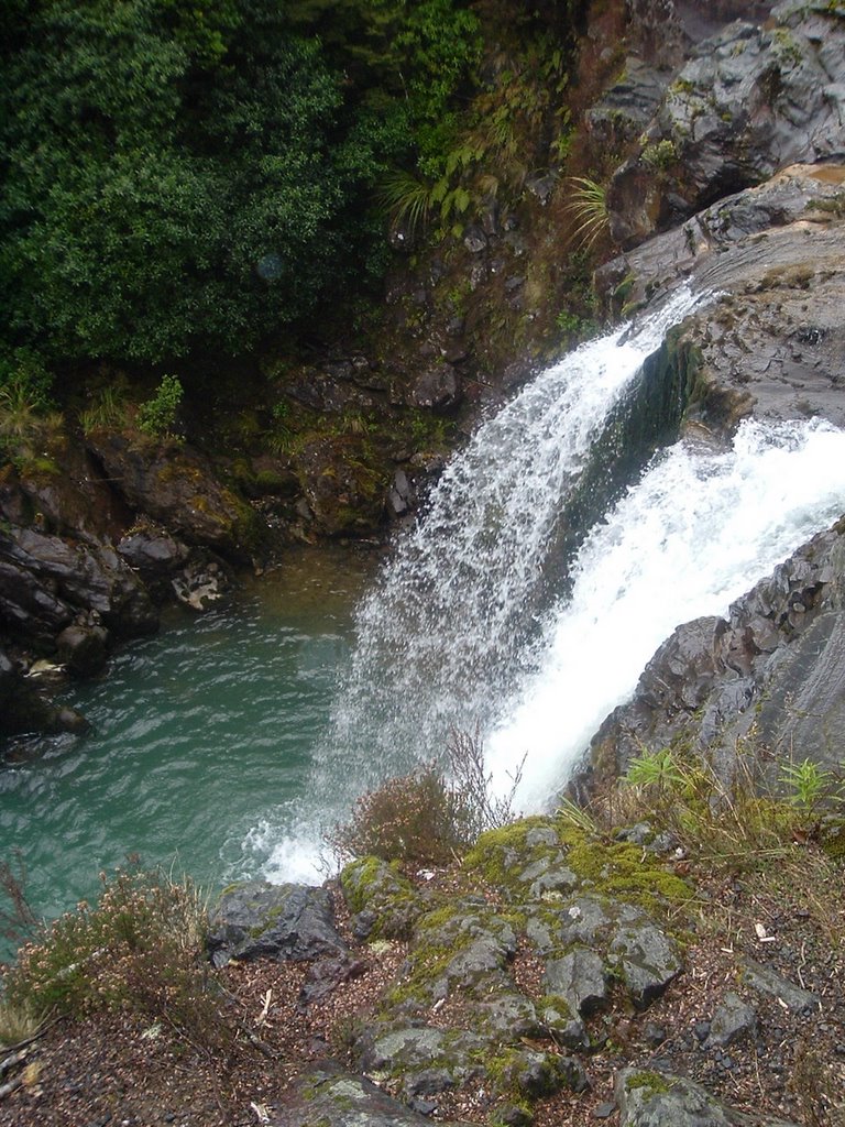
We didn't try to pack too much into our last few days at Waitomo. We drove around the area, walked to some more waterfalls (every where you look water is falling down rocks in this country), saw some beaches.
Friday, especially, we spent the day driving from beach to beach to beach, with a few waterfalls in between. We headed up north about an hour to Raglan, home to one of the most famous surf spots in New Zealand and an inviting black-sand beach. Watched the surfers ride the wave, hunted for shells. A good time, even if the sun didn't come out quite enough.
Drove gravel roads south for a while looking for a hot-water beach. There is a spot where you can dig into the sand and make your own hot tub, but we couldn't find it.
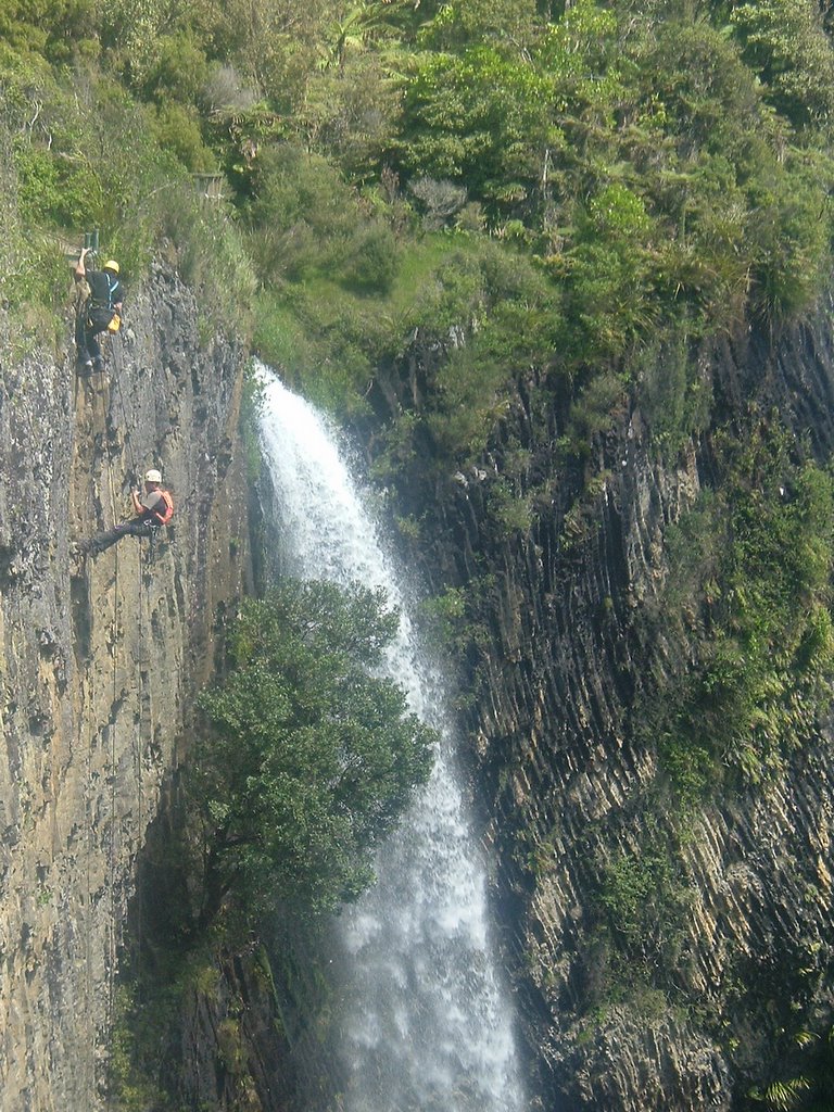
Saturday afternoon was spent underground. We settled on a cave adventure that included a 75-meter abseil (descent down ropes) into the cave, then wading and floating on inner tubes through the cave and its stream, including a fairly lengthy time with no lights to see the constellations of glow worms on the ceiling. They are small insects who give off a faint blue light, to attract and eat insects who float into the cave. It's a surreal sight - with the lights off, the roof of the cave turns into a star field. You can see where the ceiling is, but at the same time your brain also wants to interpret the lights as far-off stars.
For a finish, we had to rock-climb up about 60 feet (with a safety line) to get out of the cave.
Then Sunday, back to Wellington. We need to get out more.
We left Taupo Thursday and headed to Waitomo, known for its large
number of caves, glowworms and companies offering all sorts of ways
to explore the caves and see the glowworms, from a basic tour-group
boat ride through the caves to lowering yourself into the caves on a
rope and spending the day underground.
On the way to Waitomo, however, we took a side trip and stopped in
Rotorua at Kiwi Encounter. It's a conservation and breeding program
for the endangered Kiwi birds - rangers and others find the eggs in
the wild, grab them and send them to the lab, where they are hatched
and raised for about a year - until they're big enough to fight off
the possums and weasels which eat the eggs and young Kiwis.
The program offers a tour, including a chance to see some Kiwis.
Kiwis are some odd birds. They are the national icon of New Zealand;
New Zealanders refer to themselves as Kiwis, the dollar coin features
a Kiwi, and just about every logo seems to incorporate the Kiwi.
They are flightless, with feathers that look more like hair and a
long skinny beak, and they forage for insects and grubs at night
making it nearly impossible to see one in the wild.
I knew all that. I've seen the birds' silhouette nearly ever day
since I've been here. I wasn't prepared for actually seeing a Kiwi.
First off, they're much bigger than I expected. They said the older
Kiwi we saw was about 10 pounds, but it appeared much bigger - the
size of a full-grown turkey, but more muscle. As they shuffle along
the ground, they snort - they smell for their food and have nostrils
right at the end of their beak. The informational material at the
center explained it thusly: the Kiwi evolved to fill a niche that
anywhere else in the world would have been filled by a mammal, and
the Kiwi also evolved to look more like a mammal than any other bird.
They don't move like a bird, either - since they smell the ground
with their nose, they walk bent over. Since they appear to be covered
in fur, they give off the appearance of a anteater-like animal that
happens to be missing it's front two legs.
I kept waiting for one to lose its balance and topple over forward.
The hard part, the real shock, is when you first put your feet out the plane's door at 12,000 feet, feel the cold wind and your mind realizes there's nothing below.
Then you're out, without making any move to do so because the instructor strapped to you has all the control.
The first second or two out of the plane, it feels like you're tumbling, a surprisingly pleasant sensation. Then the instructor gains control of the air and positions the two of you in the standard pose for falling through the air - chest down, limbs out.
Mostly, the sensation of falling is gone. Instead, it mainly feels like the air is rushing at you, instead of the other way around.
But for the 45 seconds it takes to fall 7,000 feet, no matter how much you want to soak in the sights and details, your brain can barely register it all. It's too much, too different.
Jumping toward a cloud, you see a small rainbow, in a complete ring. Instead, another, smaller ring, then a third at the center, so small it's almost just a dot streaked with color. A bulls-eye that you can't hit, but then you're through the cloud, and the chute opens, and all the ground is below, lit for dazzling color and contrast, the green land and blue lake, with the crisp border of the shoreline and mountains ringing the distance.
It's easier to soak up the experience under the chute, when you're still too far up for your brain to really think of being scared of falling and there's no longer an intense collision between your body and all of the air between it and where its headed.
Although when the instructor makes a course correction, your bodies swing out from the chute, turning in a circle, and your stomach lifts further than your body, as it will on the cheap carnival rides.
Mostly, though, it's a leisurely descent, with only a few nerves rising at the end, when the ground really does seem to be coming at you far too quickly, but then a tiny lift at the right time, and you're back on the ground with barely a jolt, already wishing you were back up and above.
We're a few hours further away from Wellington in the tourist hub of Taupo. We start by driving about 10 miles north of town to the Craters of the Moon, a thermal area of steam vents (which eventually collapse, causing it's namesake look) and mud pools.
It's similar to the walks around Yellowstone, except here the ground between the steam and the pools is covered in small, hardy plants. In Yellowstone the thermal areas' ground is, well, yellow stone, along with white and faint brown, barren from the heat, minerals and nature of the steaming water. I think the relative youth of New Zealand's thermal area is the difference, but that's just a guess.
We drove back on a road that may as well have been called tourist lane - every couple of hundred yards there was another shop hoping for business. We decided to give some of ours to the Prawn (shrimp) Farm's restaurant and gift shop, as well as the Honey Hive's mead tasting, and obviously, honey.
The afternoon was a three-hour cruise on a sailboat once owned by Errol Flynn around Lake Taupo, once the site of huge volcanic explosion and supposedly the largest crater lake in the Southern Hemisphere.
The main destination of interest on the sail were some huge rock carvings done by local Maori in the late 1970s. The main interesting sight the rest of the time were the people falling out of airplanes. Taupo is the cheapest place to skydive in New Zealand, and probably the cheapest place in the world you'd want to skydive. I assume the price drops because they don't really have to worry about litigation under the country's laws, and because they do more volume than anywhere, and because it's one of the main selling points. For whatever reason, on a clear day like this, you can occasionally spot the people leaving the plane for the free fall, and you can easily see the colored parachutes drifting down, usually 10 or more in the sky at once, with waves of jumpers coming every 20-30 minutes.
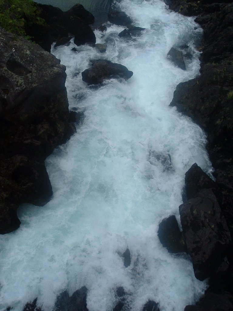
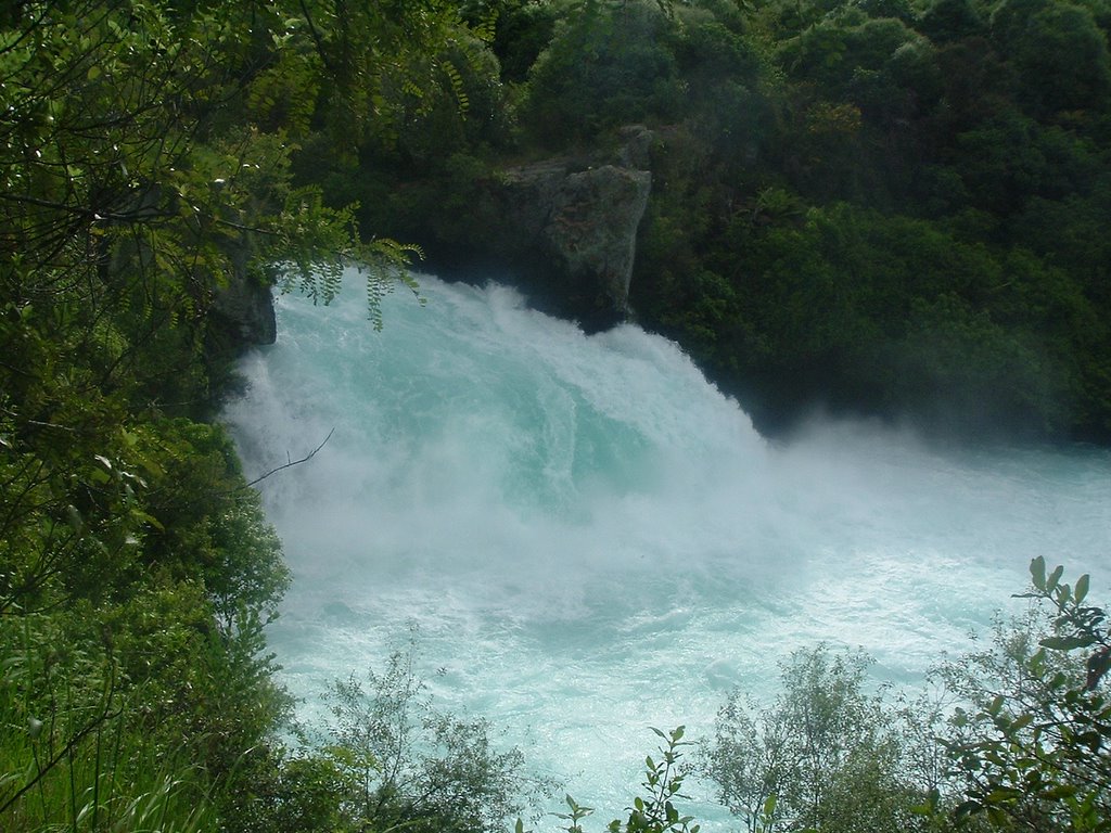
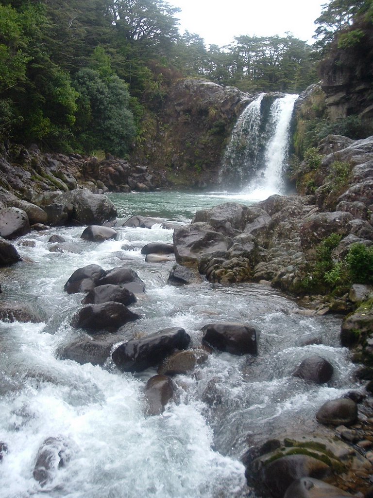
We end the sight-seeing with a trip to Huka Falls. It's not a tall waterfall, may 15-20 feet, but there is a high volume of water falling at high speed, causing the quarter-mile or so of river below the falls to churn and look like a blue, cool, larger version of the brown, boiling mudpots we saw to start the day.
(Then into town for another quiz night. And, of course, a second-place finish.)
The vegetation in New Zealand is one of the few things about this country that feels demonstrably foreign. Fern trees, a plant my mind wants to associate solely with tropical rain forests, are everywhere.
Around the volcanic mountains and plains of Tongariro National Park, the ground is covered in rust-colored, thick grasses or brown-and-red shrubs, still with the ferns scattered in the mix.
Elsewhere, the landscape is uniformly green, usually the stunning, not-quite-natural green of golf courses and baseball fields. Part of this is due to the sheep. Hillsides have been cleared of trees and the grass kept short by millions of sheep.
Even when the landscape doesn't look like a well-kept lawn, where the trees have been allowed to stand free, it only means more shades of green. Often with the fern trees poking through the pine or leafy stands.
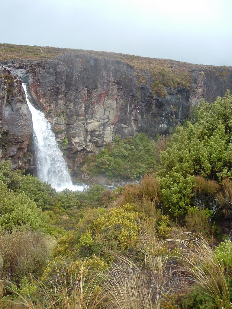
Tongariro National Park, Try No. 2.
We stayed in the same hostel Kirsten and I stopped at during our first week in New Zealand, when I went skiing here in the rain and zero visibility. After spending a few days then around these three mountains without ever seeing the peaks, we're back and hoping to actually see the sights while hiking around.
Of course, the day starts out with exactly the same weather, possibly even colder. The fog cover and misting rain means we can't see a single mountain, and we decided to concentrate on shorter hikes rather than one long one.
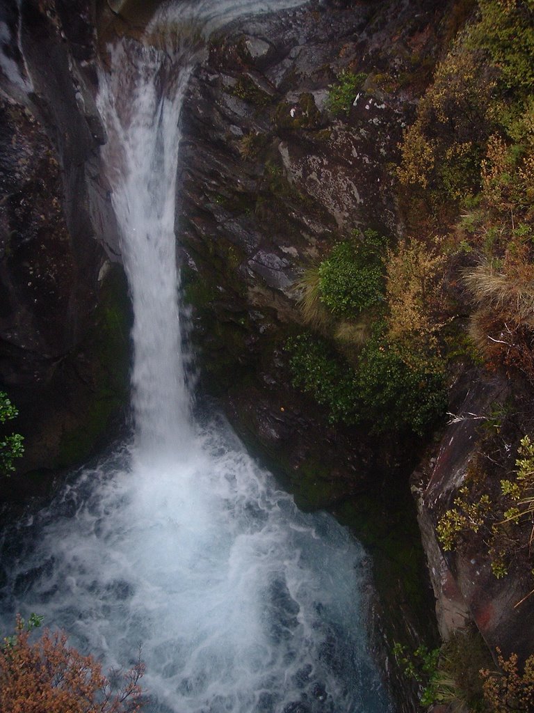
The longest walk of the day is a two-hour hike to a waterfall. As we start, the rain stops. The sun almost moves from hypothetical into reality, although the mountains remain in the mists of myth.
Layers are shed, and the falls are spotted. Five minutes later, the sun makes a sudden departure, making way for more rain, a sudden drop in temperature, then sleet. Little time to admire the falls, but not far down the path back the sun once again makes it's way out. By the time we reach the car, the bases of the mountains are visible, although I leave the park still without having seen the tops of all three.
Three of us - Kirsten and I, as well as Nick, a student teacher from Minnesota who we met in Wellington and had a week off at the same time (better known as Magnum, P.I. from Halloween night) took off for a week of hitting the tourist spots on the North Island.
After picking up a almost-too-small rental car, we headed for Tongariro National Park by way of the Wanganui River Road, about 50 miles of gravel winding through and around the hills of the Wanganui river valley.
The scenery, as pretty much always in this country, was outstanding. The road and its small villages had the air of rural solitude - we met perhaps five cars on the whole road.
Driving in New Zealand is like I imagine driving in the U.S. might have been like 60 years ago.
There is no Interstate counterpart here. Even State Highway 1, a large red line on the map, turns into a winding two-lane road spooling out and into the main street of all the towns between your starting point and destination.
In the states, a lengthy road trip means a departure point, an arrival point, and a nearly uninterrupted flow of road in between, a track for the car to follow.
In New Zealand, a lengthy road trip isn't, comparatively, lengthy. Travel is done at a more leisurely pace, especially since the country is serious about its maximum 100 kilometer an hour (60 mph) speed limit.
You drive through the towns, rather than past them, and see at least a little of what is there. You pull out at scenic lookouts, and make spur-of-the-moment decisions about pulling in at that roadside business, or taking that little hike, or seeing where that road goes.
The country doesn't exactly have all the qualities the photos, songs and movies would have you believe were there in the Route 66 days. It does have some fun diversions, of the kind I've never come across in the States unless I was taking a trip solely to see the diversions.
I love the Interstate system. I've utilized it to go to every corner of the country, to drive 1,000-mile days. I wouldn't want to take many cross-country trips back home on roads like they have here in New Zealand.
But you also miss out on something when you're driving 1,000, or 800, or 500 miles in a day. I'm sure some people take the time to find that something, to drive the back roads. But it's a lot easier to see here in New Zealand.
We're taking a week-long trip around the North Island starting today, likely with no interenet access. The sporadic posting schedule will continue when I get back.
I really should have known better.
I knew this town was nicknamed "Windy Welly" even before I moved here, but I still don't like the wind. Wind was a constant growing up, blowing the dust across the plains, or at least that's how I remember it now whenever I'm chilled by the air rushing across my skin.
Once indoors, though, it is cool to watch the clouds race across the sky. I've realized the cloud formations here are different - I don't think I've ever seen big, billowing, high-altitude clouds of the sort you'll get on a clear day back home. Here, the sky is either completely clear and blue, perhaps with a few wisps of condensation, or it's overcast with a thick, low ceiling of water mist that would be fog if it descended.
I wonder if the peculiar cloud formation is a function of the relatively small landmass surrounded by water. And I wonder if having a small bit of land out in the middle of a lot of ocean also makes it harder to predict the daily weather.
Because the weather forecasts here sure do seem to be crap.
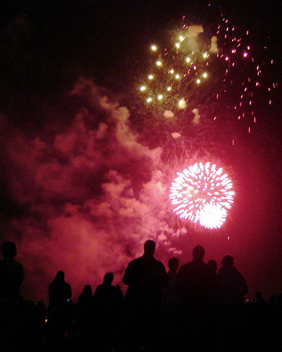 The waterfront was standing-room -only Saturday night, as all good Kiwis turned out to celebrate the foiling of a plot to blow up a government house 10,000 miles away 400 years ago by watching stuff blow up. (The only amazing thing about that last sentence is I wrote "400 years ago" just to have a number, then looked it up, and found out it really did happen in 1605.)
It was Guy Fawkes Day, which, like the Queen's head on its coinage, New Zealand apparently kept even after it decided not to actually be ruled by Britian. At any rate, there was a fireworks show, and fireworks on sale in all the stores, and apparently no fireworks laws to keep people from shooting off fireworks anywhere in the city.
The last fact was fun when we watched people on the pier shooting bottle rockets toward the general vicinity of a police boat, not to mention fireworks going off at random just about anywhere you were Friday or Saturday.
It also made for a fun extension of the fireworks show, when a grassfire started at the Mount Victoria lookout, large enough for us to see from the waterfront below (as well as watch the emergency vehicles' lights wind their way up the mountain to try and reach it.)
A good time had by all - especially since we brought food and libations.
(The photo isn't actually mine - I stole it off Flicker)
Note: Post edited to use a photo covered under a Creative Commons license. Photo taken by rachelbolstad
 I am starting to like the fact it's November and the sun is just started to shine with some regularity. I've also been in Wellington long enough the novelty of a new country has worn off, as I realized tonight in the grocery store, and found I wasn't trying to do any currency or weight conversions, or wondering about the lack of familiar brand names. This is kind of a interesting point in the trip, since I came over here to experience a new country, and at this point it's just feeling like a move to a city, although one I'm rather enjoying. However, starting this weekend we should be spending a week traveling around the North Island - there's nothing like living out of a backpack to feel like a traveler again.
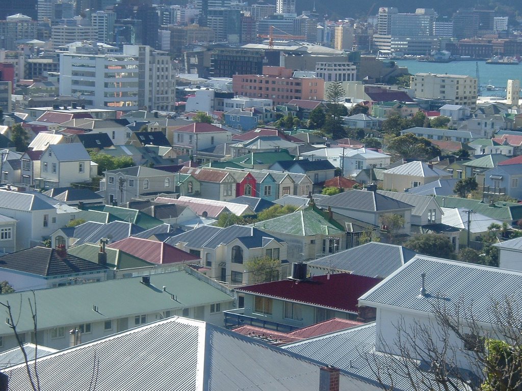
So it's also probably a good time to take stock of some of my everyday surroundings. I'm not tired of our location - we ended up with a room looking onto of New Zealand's oldest cricket grounds, Basin Reserve; and further out, Mount Victoria, one of the elevated ridges which have largely remained free of houses, buildings, or other development and instead serve as parks overlooking the city and dividing the central city from many of the suburbs.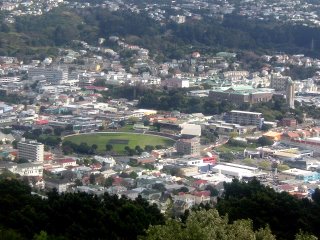 Mount Victoria is also home to the city's best-known lookout, a spot which invariably makes me involuntarily say "I can see my house from here," as one is supposed to do and as one wants, unsuccessfully, to avoid doing.
However, if you, too, want to see my house from here and join in the crass nature of the whole thing, follow the above picture's link.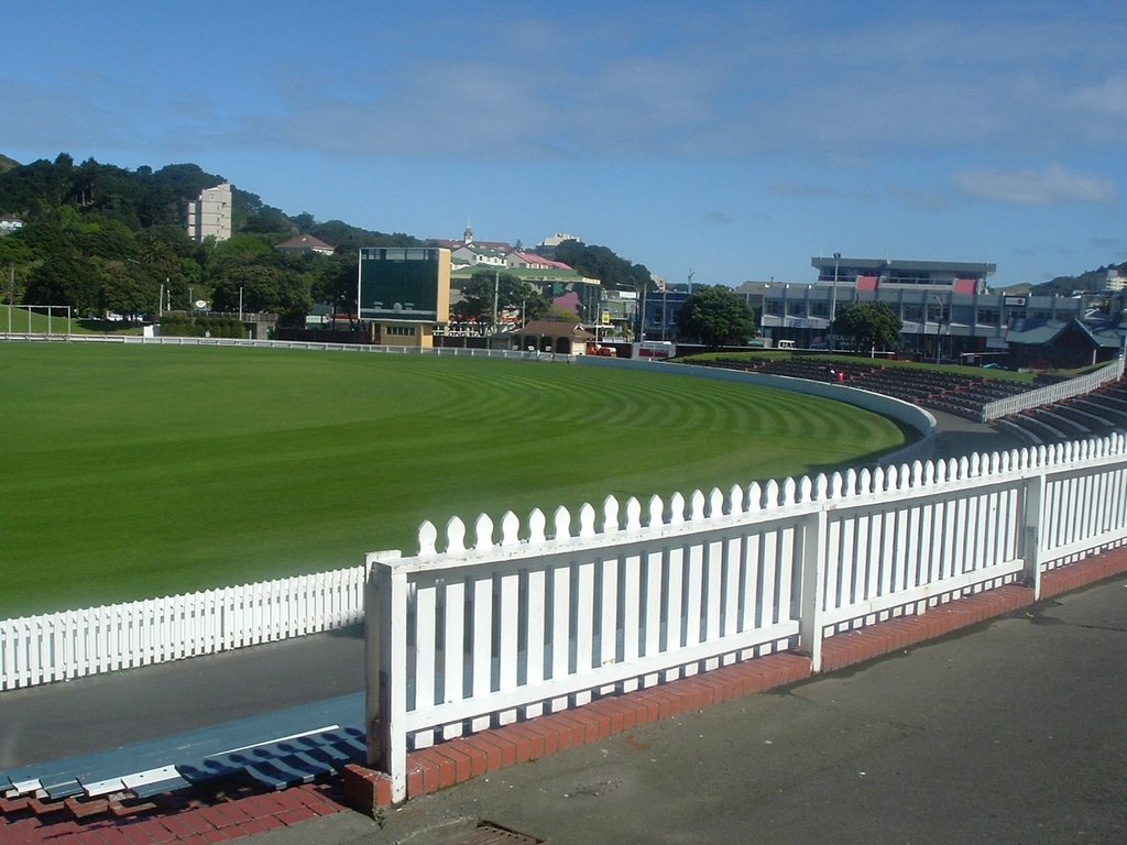
The large oval green space is the playing surface of Basin Reserve. The city, or someone, thoughtfully leaves the stadium gates open for pedestrians to wander through (although there are small signs politely asking the public to stay off the playing surface. Amazingly, this suggestion is apparently universally followed. I can't imagine such a thing happening in the middle of a city in the States. There's a lot about Basin Reserve I can't imagine happening in the States. It's one of the oldest test cricket grounds in the country; has housed some of the biggest moments in New Zealand cricket history, which really is a big deal down here, at least among the sport fans; but has become obsolete as bigger, nicer stadiums have been built. I'm thinking the best comparison is to one of the grand old-generation baseball stadiums - Ebbets Field, the Polo Grounds, maybe Tiger Stadium - which just fall into disrepair and eventually demolition.
Basin Reserve is still occasionally used for an international test match as an homage to its past, although even here the practice is apparently about to end in favor of the new parks, and regularly used for club cricket matches. And, as earlier stated, the inside of the park, the concrete walkway between the stands and field, is treated as an extension of the sidewalk.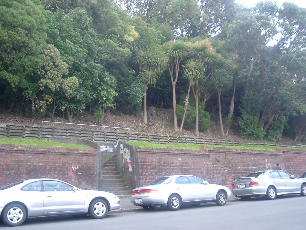
The view directly across the street from my house. Above the brick wall is a steep grass-and-tree-covered hill about 100 feet high. On top of the hill is a local university, as well as the National War Memorial: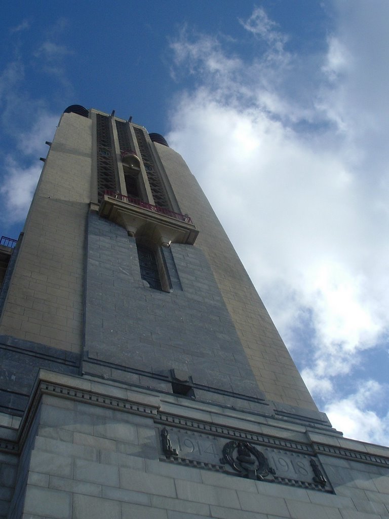
About a mile down the road, the city streets give way to the hilltop of Mount Victoria, a long ridge covered in walking trails.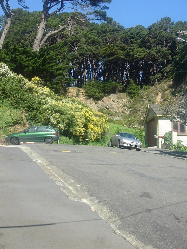
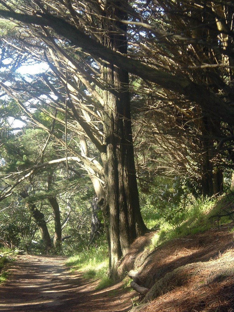
Even below the lookout, you can see the entire city center from the trails. The first picture in this post is a view of the rooftops of the Mount Victoria neighborhood, looking toward downtown.
And I'll leave you with one more "I-can-see-my-house-from-here" snap, just to act like a proper American tourist.
